Temperature data from Clam Bay, Mud Bay, Fidalgo Bay
Over the past 2 years I have accumulated temperature data from a few locations in Puget Sound, WA. Using HOBO data loggers, I collectet temperature (& some light intensity data) from Clam Bay, which is where the Manchester research station is located, from Mud Bay, which is near Bremerton and has a very productive Olympia oyster bed, and from Fidalgo Bay, which is near Anacortes and the location of an assemblage of Olys that are uniquely large.
The following screenshots from the HOBOware plots are saved in this GitHub repo’s /images folder, and HOBO/.csv files are ine data/ folder.
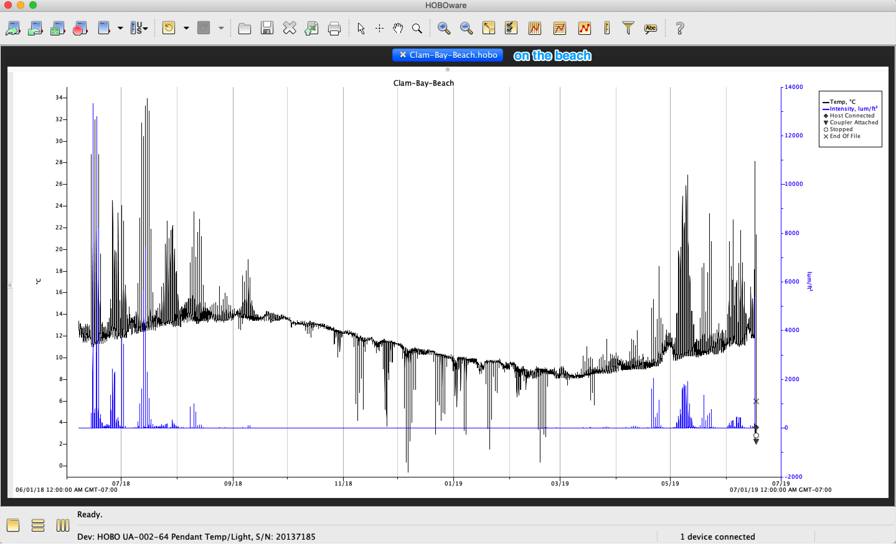
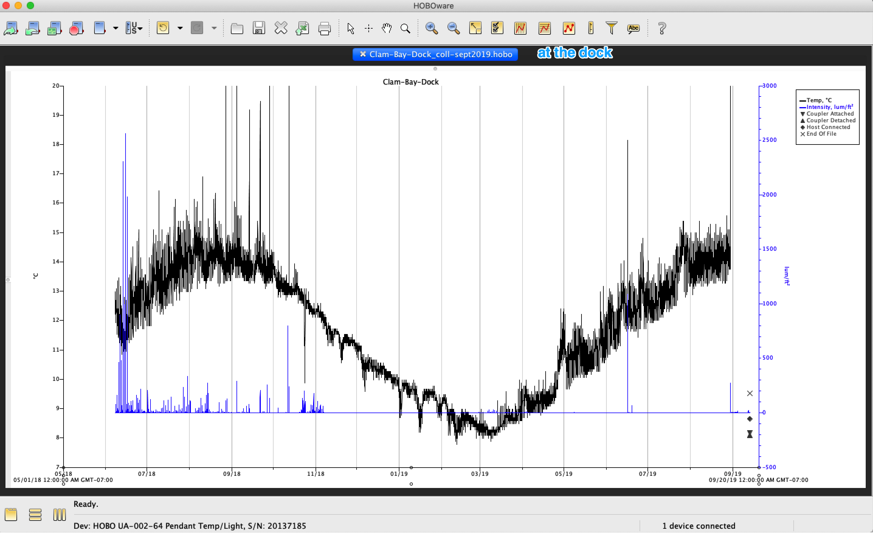
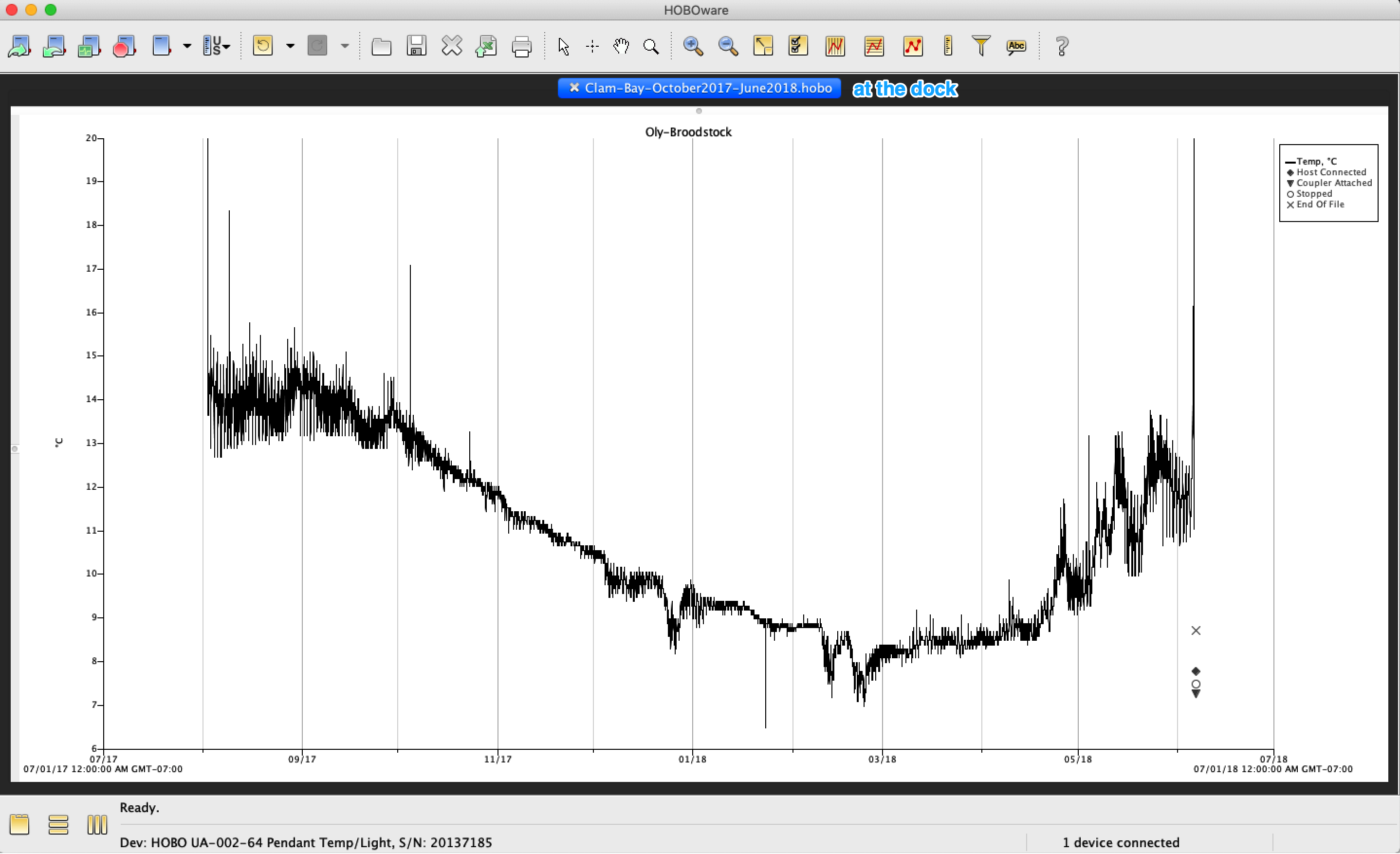
Clam Bay Data, various dates Aug. 2017 - Sept. 2019
Data Files: Clam-Bay-Temperatures
Loggers held alongside Olympia oysters hanging off dock ~1-3 meters below surface (“dock”), and inside a tumble bag attached to the racks installed on the beach (accessible below -1’). Clam bay is located at the NOAA Manchester Research Station
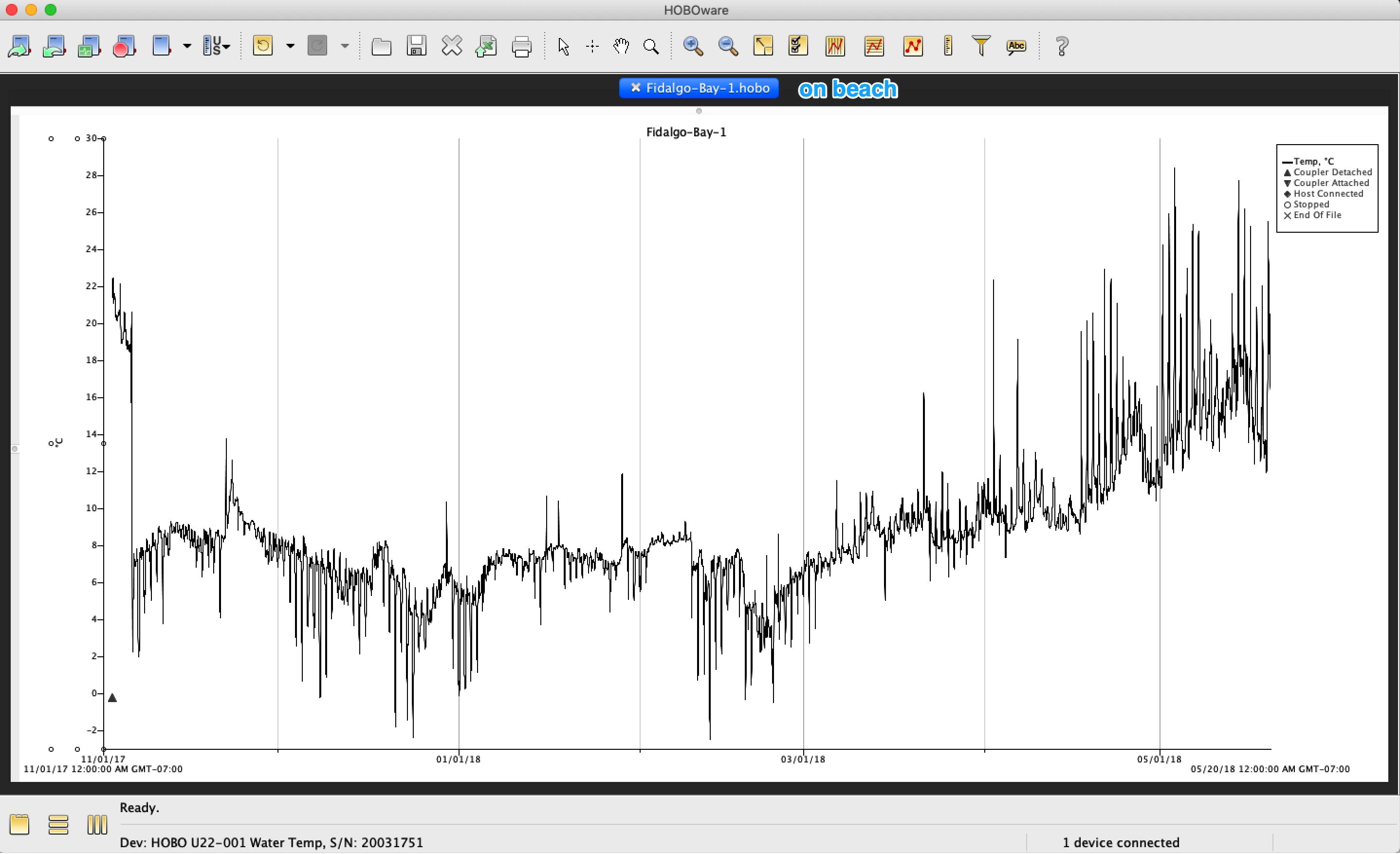
Fidalgo Bay Temperature, Winter 2017-2018
Data Files: Fidalgo-Bay-Temperatures
Deployed attached to a sunken raft at (48°28’41.7”N 122°34’26.6”W) aka (48.478238, -122.574057)
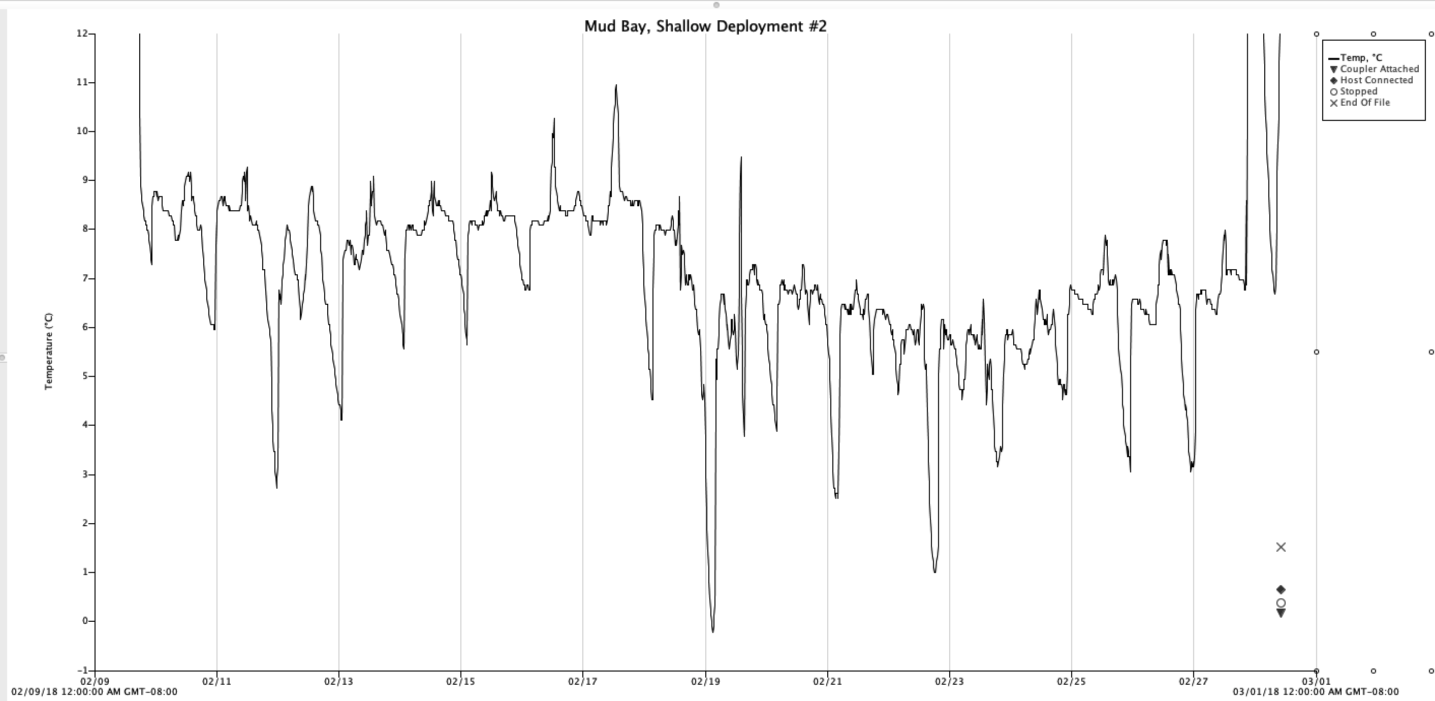
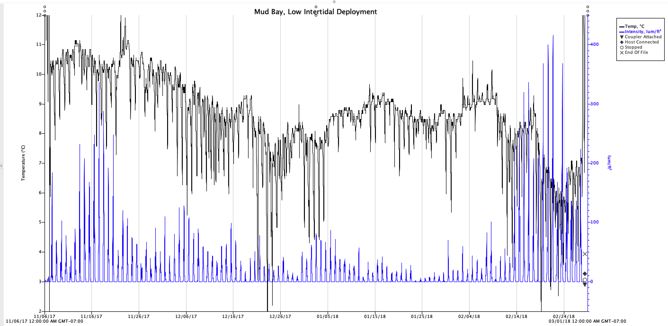
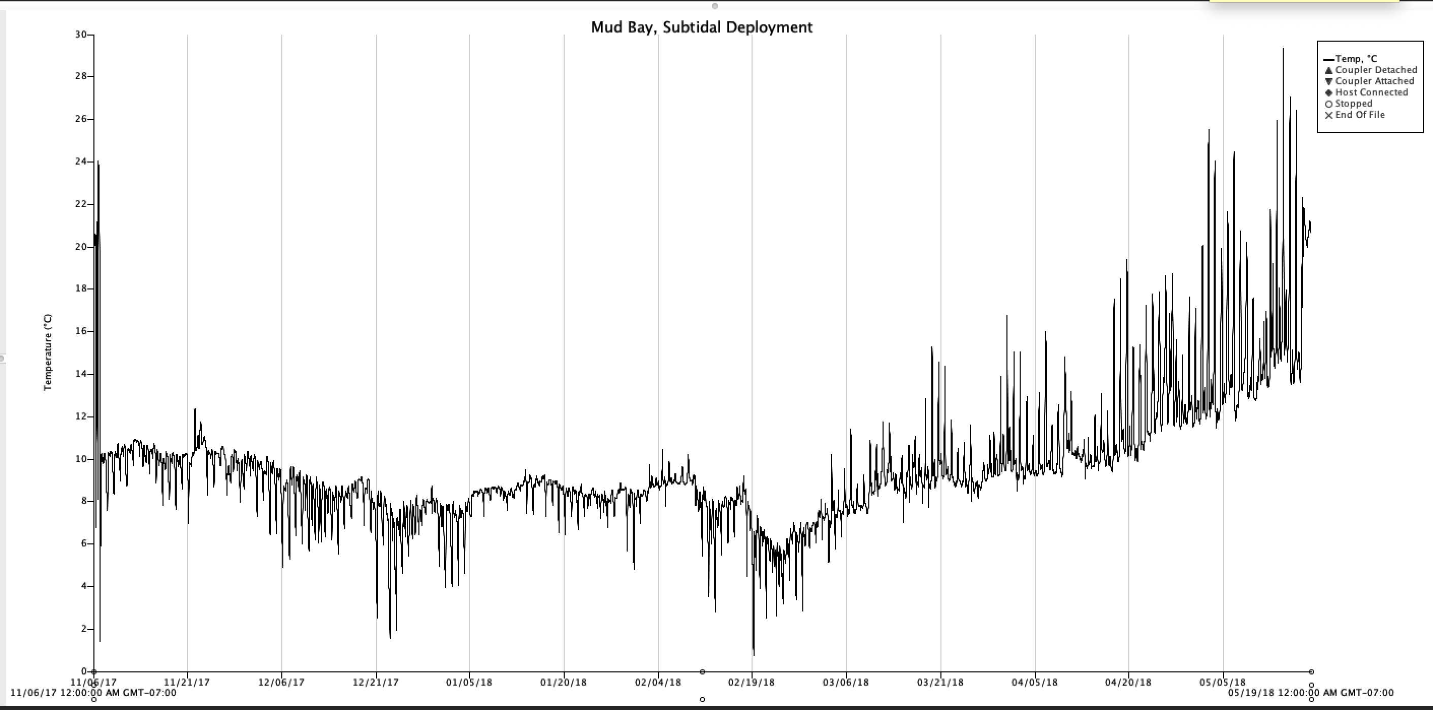
Mud Bay, Winter 2017-2018
Data Files: Mud-Bay-Temperatures
Deployed at 3 locations in Mud Bay, Dyes Inlet, approximately here: (47°35’22.9”N 122°40’22.2”W) aka (47.589681, -122.672831). Exact deployment coordinates for the 3 probes are here: 2017-11-06_Mud Bay-Temp-Logger-Locations.kml